CadPro Solutions

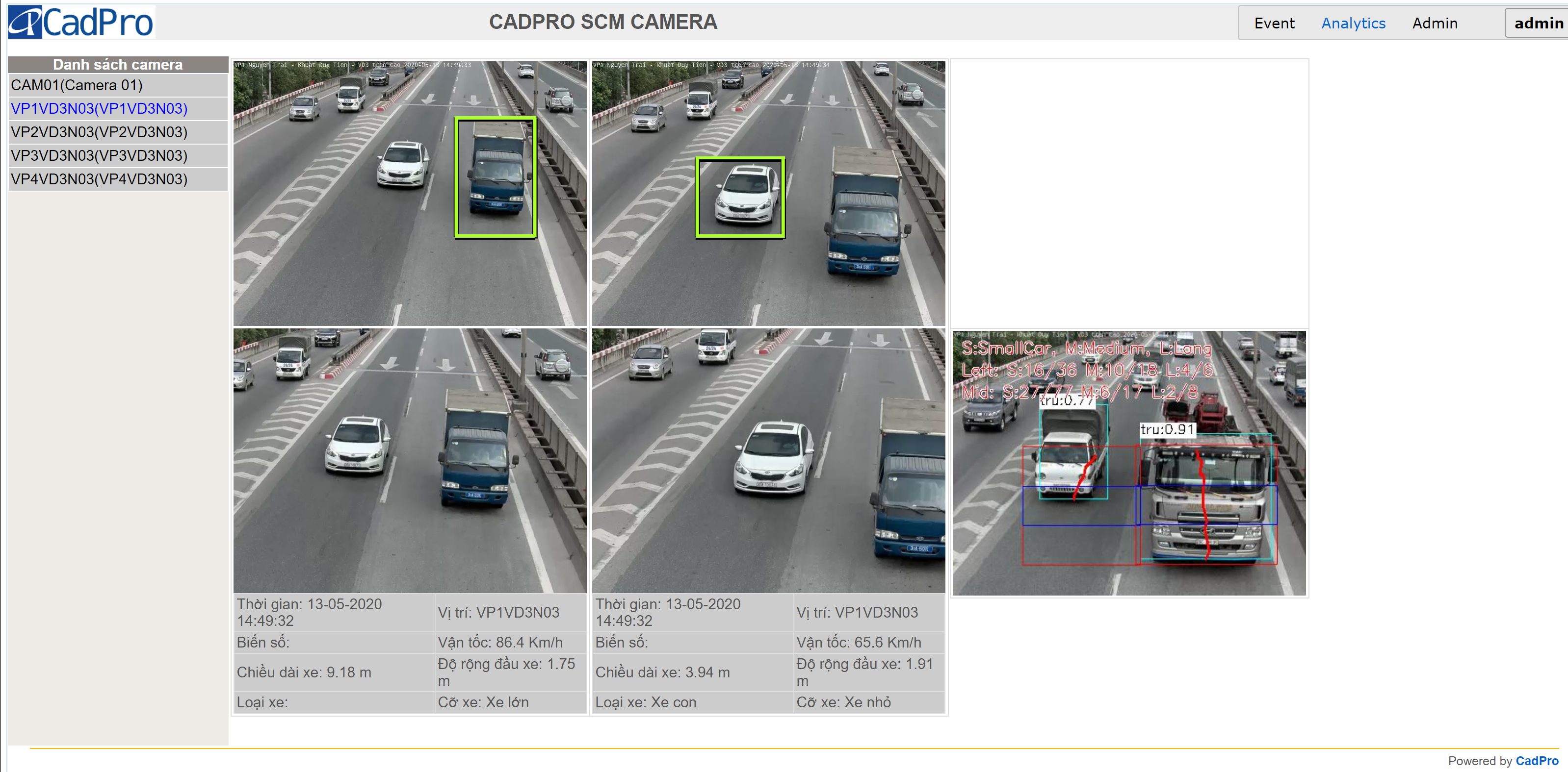
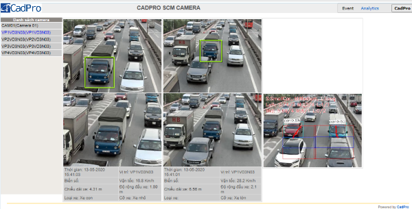
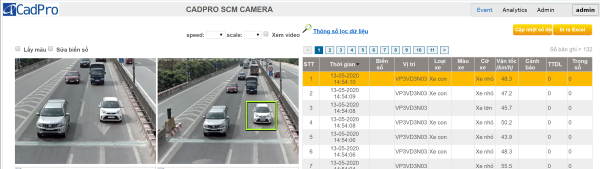
CadProSCM Smart City Monitoring System: Innovative Solutions for Urban Security, Order, and Traffic Safety

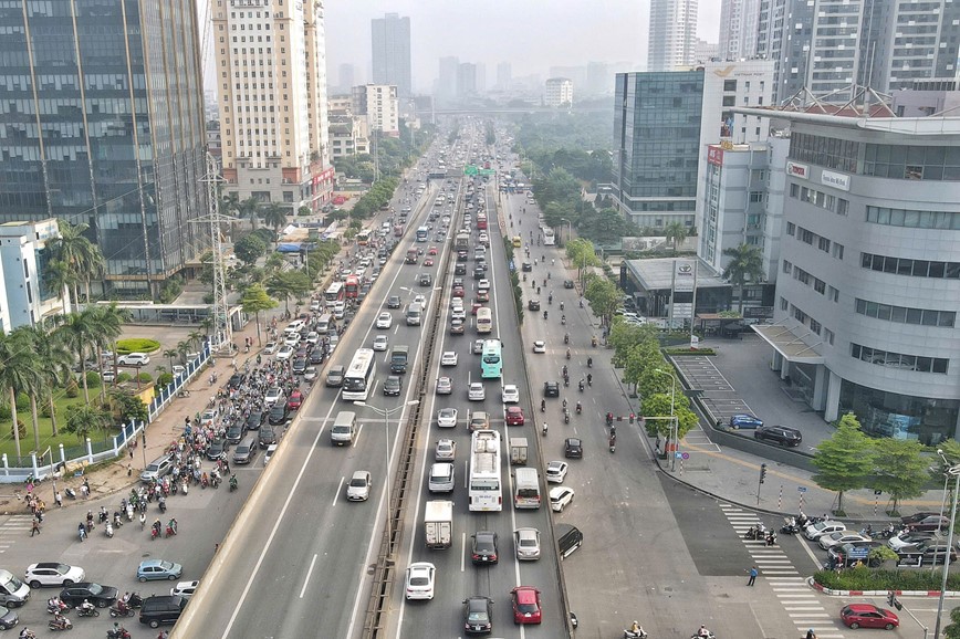
The CadProSCM Smart City Monitoring System, developed by CadPro, is a cutting-edge security and traffic management solution that has been widely deployed across various regions, including Hanoi, Da Nang, Vinh, Ba Ria Vung Tau, and major highways. This advanced system utilizes the power of AI-driven monitoring to enhance public safety, improve urban management, and ensure seamless traffic flow in urban environments.

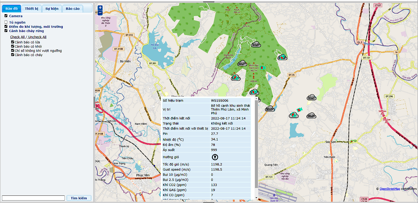
With its ability to deliver real-time monitoring, AI-based analytics, and smart processing capabilities, CadProSCM has become the go-to system for maintaining security, order, and traffic safety in urban and highway settings.

Picture11

WHY CHOOSE CADPRO SCM FOR A SAFER, SMARTER, AND MORE EFFICIENT CITY?

SCALABLE AI AND TRAFFIC MANAGEMENT SOLUTIONS

The CadProSCM Smart City Monitoring System can be customized and expanded to meet the unique needs of each installation. Whether for urban security monitoring or traffic safety on highways, these solutions are designed for:

• Modular upgrades to accommodate future technological advancements.

• Flexible configurations for diverse environments (public spaces, urban hubs, highways).

• Edge AI processing, reducing bandwidth usage and ensuring high-speed decisionmaking capabilities.

WIDE-SCALE DEPLOYMENT ACROSS VIETNAM

CadPro has successfully installed its smart city monitoring system in major cities and critical infrastructure across Vietnam, including: Hanoi, Da Nang, Vinh, Ba Ria Vung Tau, Binh Phuoc, Quang Ninh, Highways and major intersections.

These installations are supporting authorities in maintaining order, preventing crime, enhancing traffic safety, and improving overall urban management.

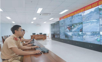
TRANSFORMING URBAN SAFETY AND TRAFFIC MANAGEMENT

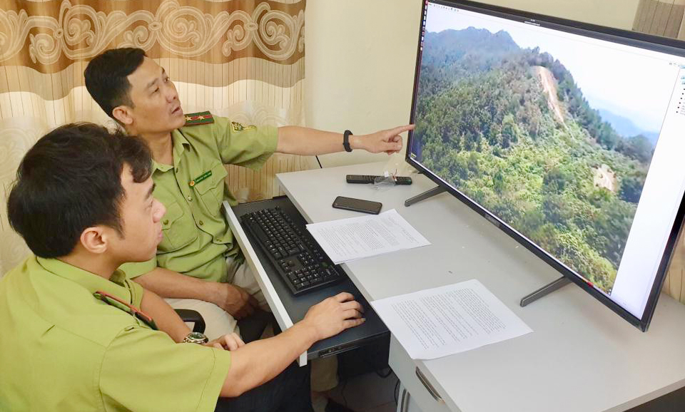
CadProSCM Smart City Monitoring System provides comprehensive, AI-powered solutions that enable cities to automatically detect security threats, manage traffic flow efficiently, and enhance public safety. With its scalable, intelligent architecture, the system is ready to evolve as cities grow and as new challenges emerge.

By integrating AI and IoT technologies, CadProSCM is shaping the future of smart cit-ies, offering real-time insights and intelligent responses to keep urban areas safe and organized.

Capture 1

PRODUCT SERIES

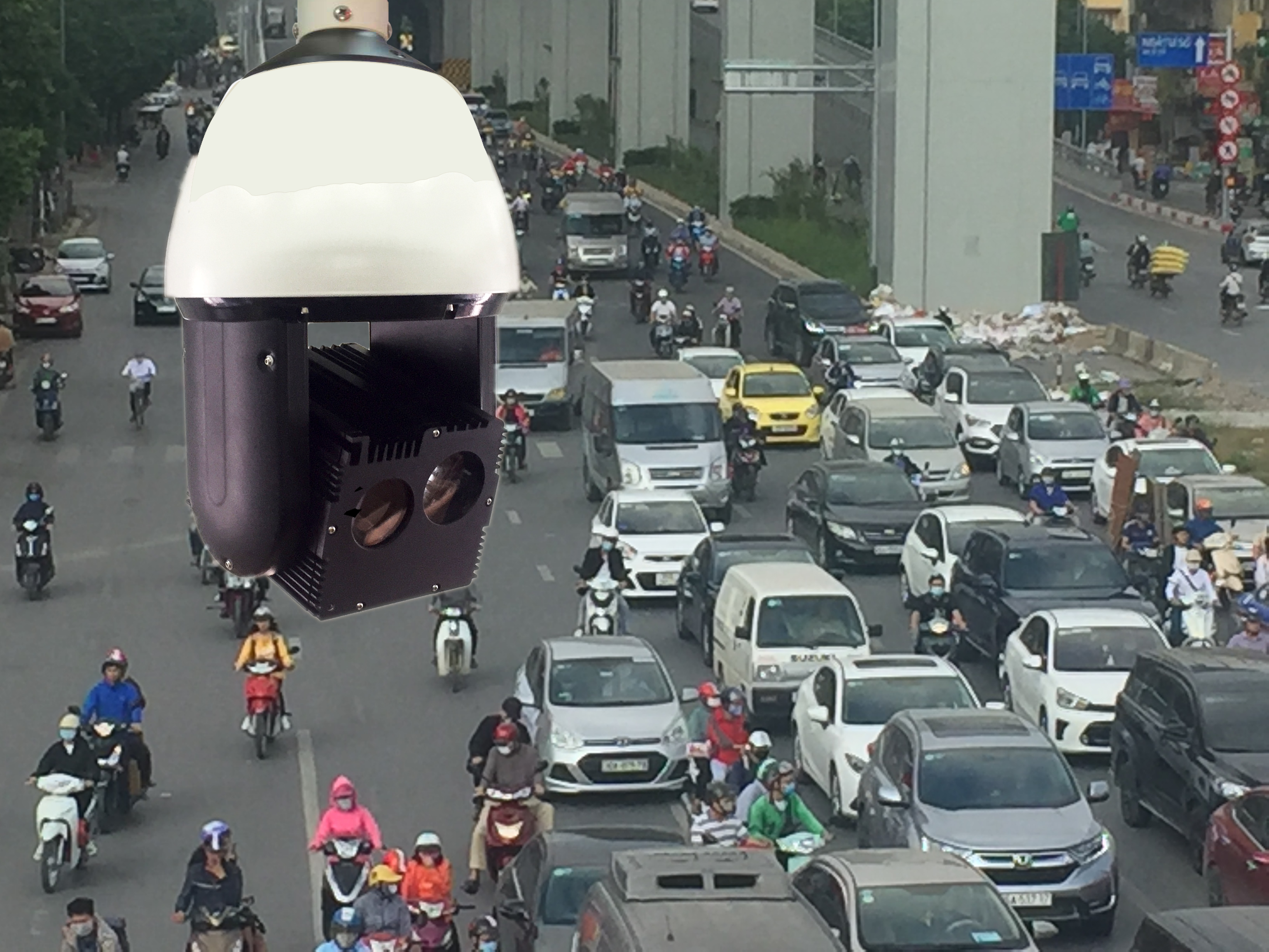
Fixed security and order monitoring equipment

Key Features

140dB Super WDR (Excellent performance even when the ratio of the luminosity of brighte stand dark estis up to 140dB.) High Frame Rate (Camera can easily catch images with no latency despite of thehigh-speed movement.) 0.005/0.008 Lux (Deliver high detailed color images even in low light environment reaching 0.005/0.008 Lux.)

IR Distance up to 200m (Enabling 200 meters distinct images at night with IR LEDs.)

Smart Stream (Bandwidth, storage and bit rate are saved with Smart Stream On, eg, H.265+ saves 70% ~ 80% bandwidth that of H.264.) Up to 12X Optical Zoom

Up to IP66-rated for Weather-resistant Performance/Vandal-proof IK10-rated

Integrated AI hardware (8-core CPU, 8GB DDR5 RAM, and 6 TOPS NPU)

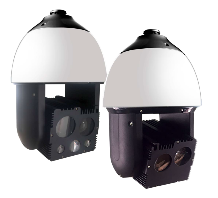
Pan Tilt Traffic and security and order monitoring

Key Features

120dB Super WDR (Excellent performance even when the ratio of the luminosity of brighte stand dark estis up to 120dB.) High Frame Rate (Camera can easily catch images with no latency despite of thehigh-speed movement.) 0.001 Lux (Deliver high detailed color images even in low light environment reaching 0.001 Lux.)

Smart PTZ Motion Detection (Pan and tilt to the position of motion detected area auto matically and zoom in synchronously.) IR Distance up to 200m (Enabling 200 meters distinct images at night with IR LEDs.)

Smart Stream (Bandwidth, storage and bit rate are saved with Smart Stream On, eg, H.265+ saves 70% ~ 80% bandwidth that of H.264.) Intelligent PTZ Auto Tracking (With Al detection, the Network Camera could leve rage motor mechanism to perform Pan/Tilt/Zoom to track the moving human or vehicle automatically and adjust zoom status flexibly according to the target distance with the powerful optical zoom capability.)

Up to 36X Optical Zoom

Up to IP66-rated for Weather-resistant Performance/Vandal-proof IK10-rated

Integrated AI hardware (8-core CPU, 8GB DDR5 RAM, and 6 TOPS NPU).

Picture1

Ways to contact with our technical support for more details:

CADPRO JSC

Add: 11 Chau Long, Ba Dinh, Hanoi

Hotline: (84) 969.733.568         

Website: http://cadpro.vn/         Email:  This email address is being protected from spambots. You need JavaScript enabled to view it.


CadPro's Smart City And Smart Traffic Monitoring And Control Systems

The Software - Automation - Control Joint Stock Company (CadPro) is a leading solution provider in the field of Information and Communications Technology (ICT), with a particular emphasis on automation control systems. Headquartered in Vietnam, CadPro has become a prominent name in the development of advanced smart traffic solutions and smart city technologies. With years of dedicated research and innovation, CadPro has introduced a diverse range of specialized products across various sectors, including traffic management, industry, education, training, military, and national security.

 z622620683651160bf6340c19401bc5676cd8f8d338960 drcc

Since its establishment in 2005, CadPro has been at the forefront of providing cutting-edge solutions and deploying complex automation systems across major cities and provinces in Vietnam. One of the company’s standout achievements is its ability to create seamless, efficient, and scalable systems for urban infrastructure, enhancing security, traffic management, and public safety.

CadPro’s commitment to the advancement of smart cities is demonstrated through several landmark projects. Notably, the security and traffic violation handling system in Vinh City, Nghe An Province, which serves as a prime example of their expertise in developing modern command centers for urban safety and automation. Launched in December 2023 and expected to fully operate by January 2025, this system marks a significant leap forward in intelligent city management.

In Hanoi, CadPro pioneered Vietnam's first smart urban traffic system, implemented in 2014. This cutting-edge system continues to evolve with regular updates and expansion, ensuring high levels of stability and effectiveness. Da Nang City also benefits from CadPro’s innovations, with its traffic monitoring system operational since 2016, and regularly upgraded through bidding packages on key roads and intersections.

CadPro's contributions extend beyond major urban areas. In Ba Ria - Vung Tau Province, the company has successfully deployed a smart traffic system and automatic surveillance cameras in two phases since 2020, which are now operating with utmost reliability. Likewise, Binh Phuoc Province's traffic and security camera system, spanning four phases and in operation since 2019, also showcases CadPro's ability to provide robust and efficient solutions for enhancing public safety and traffic management.

With a reputation for delivering high-quality, innovative solutions, CadPro continues to lead the way in transforming Vietnam's urban landscapes into smarter, safer, and more efficient environments.

Below are some of the company's landmark projects that exemplify its commitment to creating smarter, safer cities:

1. Security and Order Surveillance Camera System and Traffic Violation Handling in Vinh City, Nghe An Province

Set to be implemented from December 2023, this major project in Vinh City includes the installation of over 600 security surveillance cameras and traffic violation handling cameras at 191 strategic locations across the city. Covering key traffic intersections, city gateways, and areas critical to security, economy, and culture, the system integrates AI technology for intelligent object detection. This project will be handed over and put into operation in October 2024 and is expected to be fully functional by January 2025. The system will provide real-time data to enhance urban safety and streamline traffic management, contributing to Vinh City's advancement into a smart city.

images1978107 2

2. Traffic Control Monitoring System in Hanoi City

Since its inception in 2014, the intelligent traffic control monitoring system in Hanoi has been a model of modern urban management. With 308 traffic light control nodes, 565 surveillance cameras, and over 200 kilometers of fiber optic communication infrastructure, the system monitors traffic flow, detects violations, and controls traffic lights at critical points. Two traffic control centers ensure centralized management and efficient operation. This system has significantly improved traffic management, reduced congestion, and enhanced public safety, with its expansion and upgrades continuing to support the city’s growth as a smart urban center.

3. Da Nang City Traffic Monitoring System

Implemented since 2016 and managed by the DATRAMAC Center, Da Nang’s intelligent traffic monitoring system includes 200 cameras at over 50 locations. These cameras assist in monitoring and handling traffic violations, improving traffic safety, and reducing congestion. The system also plays a key role in crime prevention by providing valuable data for law enforcement. The integration of AI and automated data processing has made Da Nang’s traffic monitoring system one of the most effective in Vietnam, enhancing both efficiency and public participation in traffic regulation.

4. Intelligent Traffic System and Automatic Surveillance by Camera in Ba Ria - Vung Tau Province

The smart traffic system in Ba Ria - Vung Tau Province, deployed in two phases from 2020 to 2022, monitors traffic, detects violations, and ensures public safety. The system covers National Highways 51, 55, and 56, with 44 camera monitoring points, 10 speed monitoring systems, and a traffic signal control system. By detecting and addressing traffic violations in real-time, this system reduces congestion, prevents accidents, and ensures smoother and safer traffic flow across the province.

phat-Camera-quoc-lo-51-2-7346-1617701128

5. Traffic and Security Camera System in Binh Phuoc Province

CadPro has implemented a comprehensive traffic and security camera system in Binh Phuoc Province, spanning four phases from 2019 to 2021. The system consists of 125 high-quality cameras installed at 79 locations across the province. Security surveillance cameras are strategically placed in key areas, including provincial centers and gateways, ensuring a robust security presence. This system is integral to enhancing public safety, monitoring traffic flow, and ensuring the overall well-being of the community.

Screenshot 65

Conclusion

Through these projects and many others, CadPro is leading the way in the development and implementation of Smart City and Smart Traffic Monitoring Systems in Vietnam. By combining AI, automation, and state-of-the-art infrastructure, CadPro’s solutions are helping to create smarter, safer, and more efficient urban environments. The company’s efforts not only contribute to the enhancement of traffic management and security but also play a vital role in Vietnam’s broader smart city vision.


Ways to contact with our technical support for more details:

CADPRO JSC

Add: 11 Chau Long, Ba Dinh, Hanoi

Phone: (84) 24 37153714          Fax: (84) 24 37153550

Website: http://cadpro.vn/         Email:  This email address is being protected from spambots. You need JavaScript enabled to view it.


CadProWIMSW - Weighing in Motion System

he thong can dong toc do cao


The CadProWIMSW Vehicle Load Control Software System – Weighing in Motion System is a flexible system, easily compatible with international standard hardware. CadProWIMSW is easily customized for different weighing systems: Low-speed load weighing system; High-speed load weighing system; High-speed load weighing system combined with low-speed scales.

CadProWIMSW allows connection and management of vehicle load inspection data when passing through the weighing station:

 (1)        Monitoring the number of vehicles passing through the load scale        

- Display real-time images of vehicles passing through the vehicle identification system and surveillance cameras (photos of the front license plate and the lane when the vehicle passes through the weighing station; photos of the rear license plate for comparison with the previous license plate).

 - Detailed information of the vehicle (time, lane, license plate, load, speed ...).

 - Vehicle turn information.

 - View the weight weighing results.

 - Display the weight data.

 (2)        Search/filter data

- Look up inspection data to compare the registered load level and axle load.

 - Warning of overload violations.

- Export weighing slips.

(3)        Statistical reports

 - Report on vehicles violating the permitted load of bridges and roads.

- Report on vehicles transporting goods exceeding the permitted weight of the goods.

- Export statistical data into report forms according to settings.

- Integrate data for shared use between the toll collection system and the vehicle load control system; Display information online to detect and handle violations.

cprwimsw

CadProWIMSW uses the open-source Linux operating system, MySQL database and Web interface to provide features such as monitoring, statistics, control and system setup. Information, data, statistical results are displayed online and are always accessible even with mobile devices with internet connection.


For more detailed information about the solution, please contact us for the best advice!

Software - Automation - Control Joint Stock Company (CadPro)

Address: No. 11 Chau Long - Ba Dinh – Hanoi

Hotline: (84) 969.733.568

 Email:   This email address is being protected from spambots. You need JavaScript enabled to view it.

Website: http://cadpro.vn


Landslide and flood early warning system based on IoT and WSN technology


Landslide and flood early warning system is an integrated solution of advanced technology based on the Industrial Revolution 4.0 platform, including IoT on-site sensors automatically monitor and record parameters that cause landslides and flash floods such as: slope displacement, hydrological and physical properties in soil, as well as precipitation using various tools. Measuring machines: rain gauge; extensometer, inclinometer, rotameter, total station, laser scanner and acoustic emission sensor (AE) and GPS to observe slope displacement and deformation. Time-do- main reflectometer (TDRs), strain gauges and barometers for mea­suring changes in the hydrological and physical properties of soil.

.

sat lo dat 1


Sensors, alarms and on-site data processing nodes that communicate over a low-energy wide area network (LPWAN) are the main components of the system for early warning landslides and flash floods. This network allows very low energy devices to transmit radio information at very long distances, the ground point to point can reach tens of kilometers, and if a balloon is used as a relay station, the information can be transmitted as far as hundreds of kilometers.

In residential areas located in an accident-prone area, incident sensors are installed that automatically send out warning signals when they are buried or collapsed. This system sends a signal to emergency rescue units that occur immediately after an accident so that the response time is fastest, and the loss of life is minimized.

sat lo dat 2

OPERATION PRINCIPLES OF MONITORING AND ALARM SYSTEM FOR SLOPE LANDSLIDES

Equipment for measuring slope displacement (SMS): including AE sensor, satellite positioning device with 2.5cm accuracy, pore water pressure sensor; LPWAN transmitters (low power wide area network), renewable power source. On-site data processing node: collect data from measuring equipment, signal threshold processing, alarm trigger and transmission of information to the Internet. Alarm equipment (ALARM) in residential areas: sirens, lights in each residential area, radio receiver. Central operating system record information from networks of sensors, apply numerical and AI prediction model to evaluated data history, gives early warnings on areas requiring special monitoring (incorporates rain forecast data), wide area network information via Internet, text message, telephone, Direct information on site status with  disaster forecasting, disaster prevention, rescue local agencies, installation just plug in without drilling), operate commissioning (auto threshold detection, remote monitoring center connection), ultra-low power consumption from solar cells.

OPERATION PRINCIPLES OF MONITORING AND ALARM SYS­ TEM FOR MUD FLOODS

Mud flood measuring equipment installed on stream bed (AES): AE sensor, water level sensor; flow speed and volume sensors; LPWAN transmitters, renewable power sources. The slope displacement meter (SMS) is installed on a slope where there is a possibility of a landslide. On-site sensors are de­signed to be installed without drilling. Energy-saving ultra infrared image Al analyzer. On-site data processing node and rain gauge. Artificial intelligence and cloud-based real time analysis with fast notifications. Residential alarm device (ALARM). Central operating system sends public notifications about possibilities of landslide, flush via text messages, phone, live information of field status with disaster forecasting, disaster prevention, rescue, local agencies.

OPERATION PRINCIPLES OF MONI­TORING AND ALARM SYSTEM FOR SPILLWAY FLOODS

Flood measuring equipment (AES) is installed upriver. Alarm device (ALARM) at the spillway underground (+ on-site data processing node + rain gauge). Installation (in the small rock pool upstream), operation (automatic threshold detection, remote monitoring center connection), ultra-low power consumption from solar cells. Using low energy wide area network (LPWAN) technology, connecting information systems with integrated disaster rescue and prevention. This is the research result of the state-level project VT-CN.04/17-20 that has been accepted "Research on technology access using balloons dropped in the stratosphere with integrated technology of information transceiver station for monitoring, navigation, search and rescue and mea­surement of atmospheric physical environmental parameters”.

.

 For more detailed information about the solution, please contact us for the best advice!

 Software - Automation - Control Joint Stock Company (CadPro)

Address: No. 11 Chau Long - Ba Dinh - Hanoi

Hotline: (84) 969.733.568

 Email:    This email address is being protected from spambots. You need JavaScript enabled to view it.

 Website: http://cadpro.vn


Smart forest fire early warning and monitoring system

The forest fire early warning and monitoring system deployed by CadPro uses modern Internet of Things (IoT) technology with low power wide area transmission (LPWAN), centralized information management on GIS maps to effectively support the prevention and reduction of damage caused by forest fires


anh 1

Overall system modelanh 2

System physical architecture model

Smart forest fire early warning and monitoring devices are divided into the following main layers:

- On-site equipment layer: Including smart optical monitoring sensors Zoom 36X (PTZ), Wifi signal transmission device integrated with LPWAN, Industrial 3G/4G communication equipment, Renewable energy system for smart optical monitoring sensors, Gas monitoring sensors, Renewable energy system for gas monitoring sensors.

- Data transmission network layer: Using low-power wide-area network (LPWAN) ensures industrial, reliable, high bandwidth and wide geographical coverage.

- Database service layer and central processing (server room): Central equipment and software system provides high availability database, strong computing and service capacity, scalability and unlimited number of data mining sources (operational stations at the center, data mining points on wide area network, system status notification for field operators and participation in forest protection monitoring...).

- User exploitation and control layer: Forest fire monitoring and early warning system provides user interfaces for monitoring and control needs in the monitoring room or via the Internet.

giao dien pm chay rung 2

Software Interface of Smart Forest Fire Monitoring and Warning System

Advantages of the Smart Forest Fire Early Monitoring and Warning System deployed by CadPro:

  • The system is designed and built on the basis of applying advanced technologies in the world in the field of smart forest fire early monitoring and warning.
  • Reduces the time to detect fires and coordinate firefighting forces.
  • Automatically detects, monitors day and night, protects 24/7.
  • Provides real-time weather data and images.
  • Artificial intelligence software automatically analyzes images, searches for and detects smoke and fire areas, provides high-resolution images to send to the regional forest fire monitoring command center.
  • The monitoring software operates on the Web-GIS platform, has the ability to set up forest fire notifications via text messages, emails, and warnings on maps with sound and images.
  • Easy to use, warranty, maintain and service.

TB chay rung 1

TB chay rung 2

Actual installation image of Smart Forest fire early monitoring and warning system 

Can-Bo-Chi-Cuc-Kiem-Lam-Ha-

Forest rangers monitor the forest via camera system

The forest fire warning system operates 24/24 hours and transmits images to a large screen located at the Forest Protection Department or via smartphones and tablets of each ranger with internet connection. When a forest fire is detected, the location and type of forest are determined, and the mobilization of forces to participate in firefighting is carried out quickly and effectively.

 For more detailed information about the solution, please contact us for the best advice!

 Software - Automation - Control Joint Stock Company (CadPro)

 Address: No. 11 Chau Long - Ba Dinh – Hanoi

Hotline: (84) 969.733.568

 Email:    This email address is being protected from spambots. You need JavaScript enabled to view it.

 Website: http://cadpro.vn


CadPro Smart Vehicle Counting Solution

The intelligent monitoring system integrated with artificial intelligence CPR_SCM has been deployed to count vehicle traffic on Hanoi Ring Road 3.

The Hanoi People's Committee issued Decision No. 1774/QD-UBND dated April 29, 2020 on the urgent repair of the bridge bearing misalignment incident at the T50 and T91 pillars of the elevated Ring Road 3 (VĐ3TC). To implement the above decision, the Hanoi Department of Transport has organized vehicle counting to determine the traffic volume on VD3TC from Cau Dau to Mai Dich Bridge and vice versa.

To count vehicles, the Traffic Works Maintenance Board has used 2 technologies: 

  • Counting vehicles using air tubes (originating from the US).
  • Counting vehicles using the intelligent monitoring system integrated with artificial intelligence CPR_SCM manufactured by CadPro


Although the pneumatic tube technology automatically counts the axles that run through the tube, due to the installation on the road surface, there is a possibility of causing traffic incidents/accidents due to the tube bursting, so the system is still operated manually, requiring a person on duty, a deceleration sign, and warnings from the vehicle counting station.

Unlike the pneumatic tube technology, which only counts the turns of the tire running on the rubber tube, cannot distinguish the type of vehicle, and counts incorrectly when the vehicle travels parallel on 2 lanes with a strip of tube installed or between 2 lanes. In crowded cases such as VD3 during rush hour, 3-axle and 4-axle vehicles can be counted together. CPR_SCM technology uses an embedded computer with an integrated camera and artificial intelligence software to identify vehicles and count vehicles through camera images with high accuracy, automatically classifying vehicles by size and shape. With just 1 device, it is possible to accurately count vehicles traveling in different lanes, separate the traffic volume of each lane, count by vehicle type, vehicle size, and speed. With advanced requirements, the system also provides license plate numbers for each vehicle.


Image of the vehicle counting system software on the elevated road on the 3rd Ring Road. CPR_SCM technology does not require installation of equipment on the road surface, does not affect traffic safety, and is automatic 24/7

           Live video recording of the vehicle counting system on the elevated road on the 3rd Ring Road

SYSTEM FEATURES

  • All information on vehicle traffic volume, vehicle flow speed, etc. are automatically collected in real time.
  • Traffic flow statistics reports for analysis, evaluation, traffic coordination, and traffic condition improvement processes.
  • Intelligent image analysis to detect movement and speed of movement.
  • Direct monitoring, recording, and storing images of traffic incident scenes or dangerous traffic conflicts.
  • Collect and process images simultaneously from multiple cameras to analyze traffic data, and at the same time issue warnings about traffic incidents and events, providing traffic information to the ITS Center for timely handling.


                                          Intelligent image analysis feature

CPR_SCM PRODUCT TECHNOLOGY

Modern smart city monitoring technology CPR-SCM 4 in 1:

  • AF camera for day and night surveillance, automatic patrol, image data collection, analysis, warning.
  • Powerful embedded computer, AI software for object recognition, security assistance, traffic statistics.
  •    Urban environmental air quality sensor.
  • VoIP communication allows people to exchange incident and accident notifications with the command center.

Following the strategy of "proactively participating in the 4.0 Revolution", CPR-SCM is the latest generation of "smart city monitoring eye" devices that provide a variety of information covering a wide area and details about security, safety, observation and data analysis on a single device according to the Artificial Intelligence (AI) model connecting the Internet of Things (IoT).

Integrating a large optical zoom lens, Sony IMX super-sensitive image sensor, industrial computer with high-speed multi-core CPU and GPU, Artificial Intelligence (AI) technology for intelligent image processing, environmental sensors for gas, noise, and patrolling pan and tilt controllers. Not only is it an IP camera that provides excellent image quality with super low latency of up to 200ms, CPR-SCM also automatically processes images with Artificial Intelligence software, identifying, detecting and warning of violations of traffic safety and social security.

CPR-SCM is equipped with intelligent features, moving between preset locations, analyzing images, automatically zooming in, recognizing objects, evaluating events and issuing corresponding warnings: exceeding density thresholds (traffic jams, large crowds, security warnings); abnormal movement speed (illegal parking, picking up and dropping off passengers in the wrong place, intrusion events...).

In addition to the features of a smart camera, CPR-SCM also provides two-way IP audio communication for voice communication between the scene and the center, air quality measurement information at the camera location such as PM2.5/PM10 index, air quality, temperature, humidity, pressure in real time. With a distributed processing architecture, the CPR-SCM system minimizes bandwidth requirements connecting to the center, is reliable and ready to work 24/7 without creating network congestion, reducing storage and server investment costs.

Data from CPR-SCM integrates images, sounds, events of identified objects (license plates, vehicles), vehicle routes, historical events of traffic safety violations, security events, congestion, etc. displayed on a digital map with coordinates, time, etc., convenient for exploiting modern smart city planning and management.

CPR-SCM provides many extremely powerful customization options for features suitable for the harshest outdoor environments and climates, flexible in installation configuration and requirements for monitoring and processing functions for security monitoring and control of smart cities, roads as well as airports, ports, warehouses, etc.

CPR-SCM is the first image monitoring device capable of automatically determining vehicle route coordinates on a digital map. Events and routes are easily queried by timeline and geographic location.

For more detailed information about the solution, please contact us for the best advice!

Software - Automation - Control Joint Stock Company (CadPro)

Address: No. 11 Chau Long - Ba Dinh – Hanoi

Email:   This email address is being protected from spambots. You need JavaScript enabled to view it.

Website: http://cadpro.vn